Jim Conrad, N4WFP, had participated in previous NCnearSpace flights and was interested in an HAM radio experiment. Could a stratospheric payload act as a HAM packet radio repeater for much of the East Coast? He previously participated in the Appalachian Trail Golden Packet event and another was coming up on July 19, 2025.
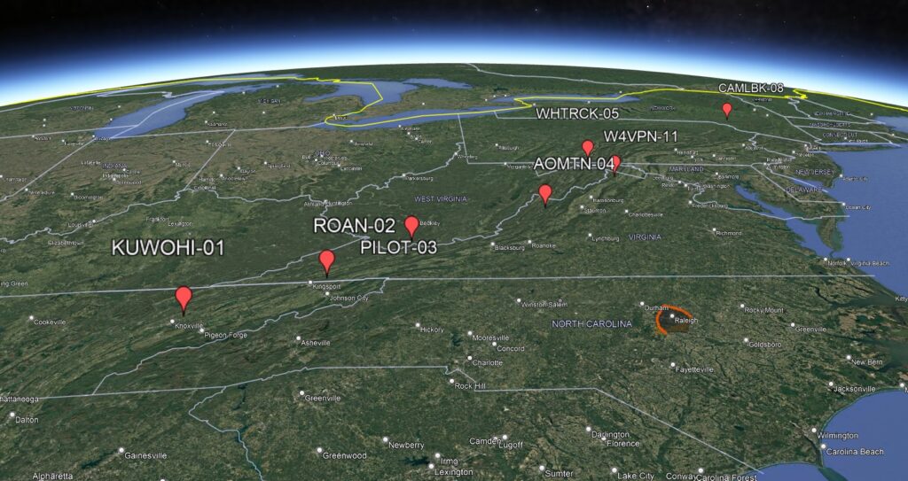
Jim and Paul L designed a mission that would fly a packet radio repeater up over central North Carolina while this event was underway. This airborne repeater would receive communications from a large stretch of the Appalachian Trail and relay it back to the ground where a radio-to-internet gateway (iGate) could relay it again to the Internet.
Paul wished to test a new version of LoRa Pi-in-the-sky. Two payloads would help minimize radio interference between the two projects and the GPS receivers.
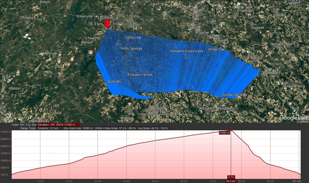
Below: Paul testing out a 2m quarter-wave ground plane antenna using his tiny Vector Network Analyzer. The projected flight path had a landing just south of the launch site, so southern Wake County was chosen as there are more open fields there.
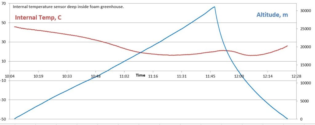
The upper payload was a small plastic box holding the packet repeater. It had an ‘X’ shaped truss of thin foam holding the 22-guage ground plane wires, while the active antenna wire fed downwards along the string.
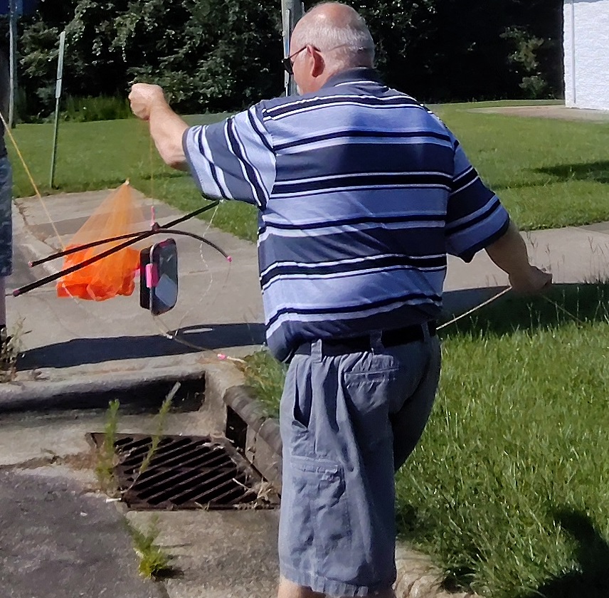
Jim holding the upper payload with the 90cm orange parachute.
About 6m below flew Paul’s experimental LoRa payload. It held an AP510 APRS tracker; Mobius mini video camera; Raspberry Pi with camera, GPS, and LoRa transceiver. A foam wing was added to slow the spin for the video camera.
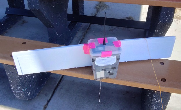
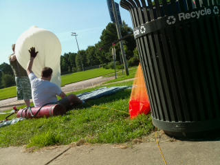
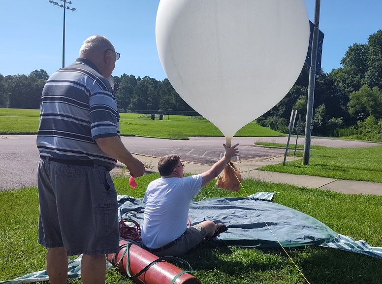
Image taken by the Pi camera during fill. Testing neck lift of the balloon — about ready to fly!
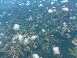
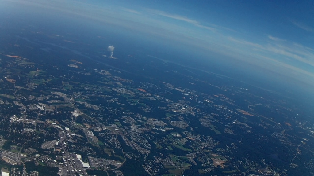
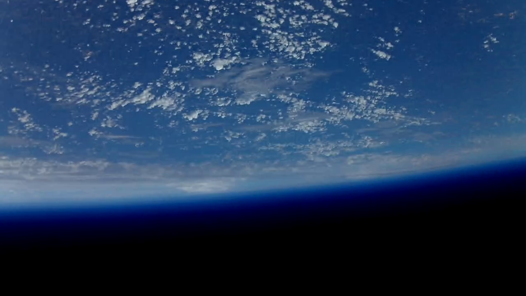
Image of Fuquay Varina from the Pi camera. Views west towards Shearon Harris (steam plume).
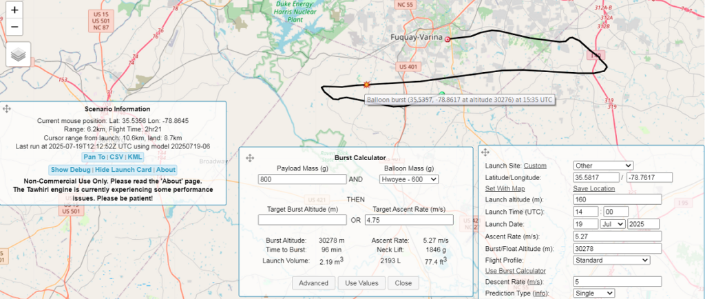
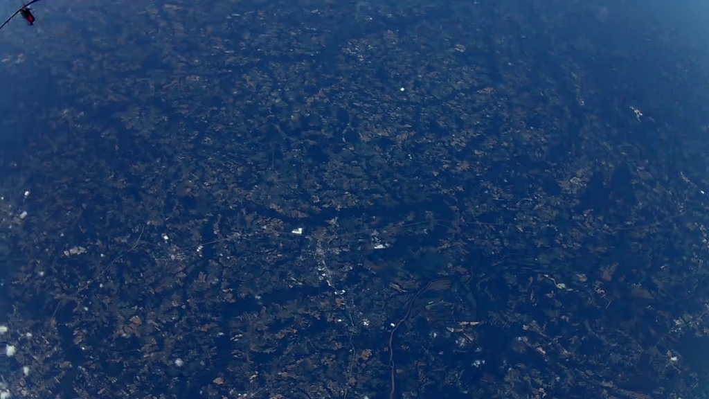
Just after launch, the Pi ran into a power issue and started repeatedly rebooting. It was able to take many still images but transmission of these images were limited and GPS lock failed. The AP510 continued to give tracking data while Jim’s radio started repeating Appalachian Trail data packets. The radio heard many of the stations along the AT (see map at top of this post), but there were issues with the ground-based iGate that prevented the repeated information from getting on the Internet. [Try again in 2026?]
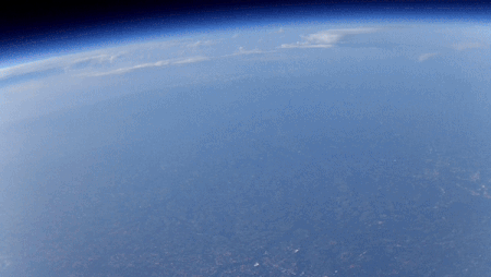
Mobius mini camera images looking west towards storms in Tennessee and east to the clear skies over the coast (and typical clouds over the Gulf Stream).
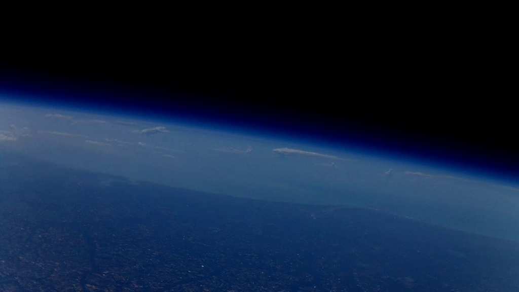

Pi camera image at 30km
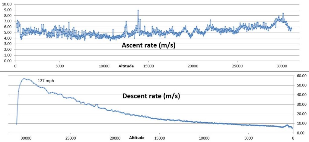
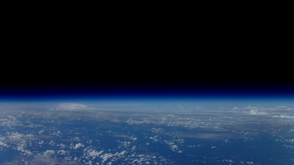
The flight track proceeded as expected with burst occurring at 31.1km (102,048ft).
Video clip of burst from the Mobius Mini camera
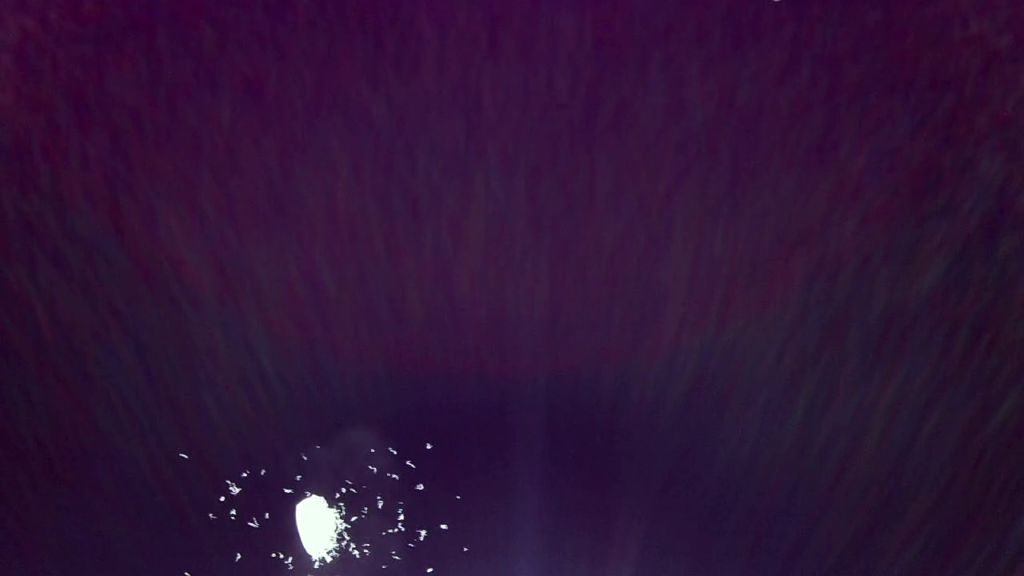
Above are: Image of burst from Pi camera, from Mobius inverted and then a few seconds later showing Wake County below with just a glimpse of the upper payload in the top left.
The payload descended into a set of farm lands just south of Wake County, but of course it decided to land in a patch of very tall trees.
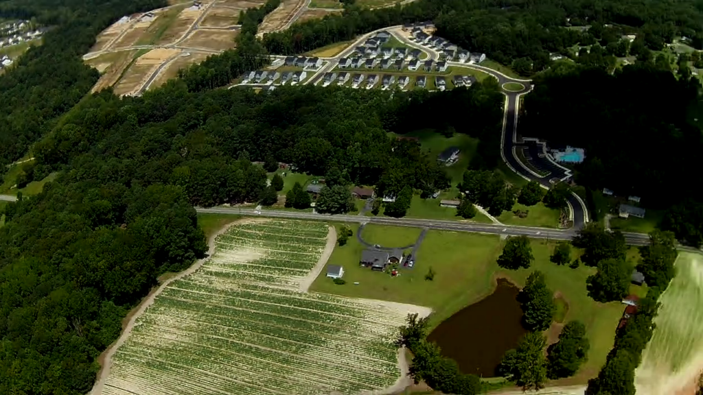
Below: Coming in for landing with open fields. Image from the onboard camera high in a tree — if you look closely you can see Jim and Paul looking up from below.
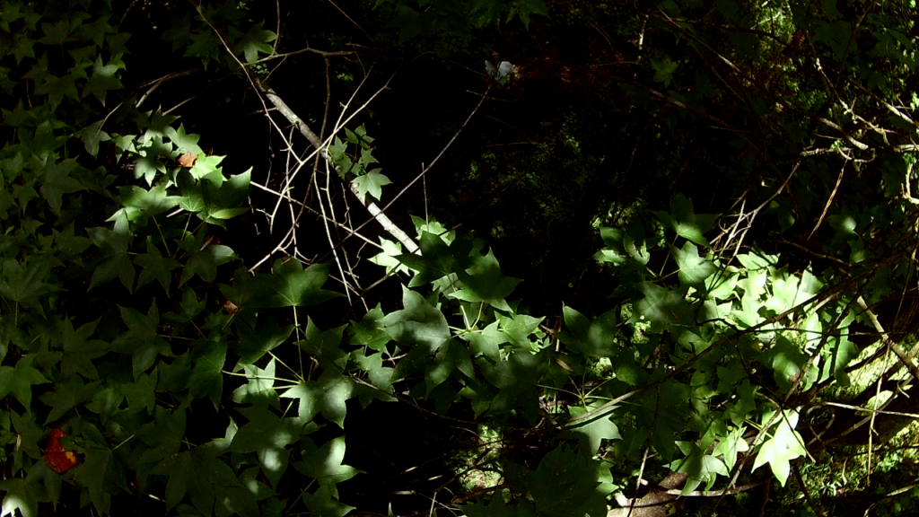
Jim and Paul visited with the landowner and then ventured into the woods. Later Jim would inspect the stuck payload with his drone. Later Tim W and his bow & arrow rescued the payload on the first shot. Thank you again Tim!